Designing Maps That Help People Move With Confidence
News & Insights
News & Insights
Maps are one of the most powerful tools in the wayfinding experience. They help people understand where they are, where they’re going, and how a place is organized. Long before someone follows a directional sign or asks for help, a map can establish orientation, reduce stress, and create confidence.
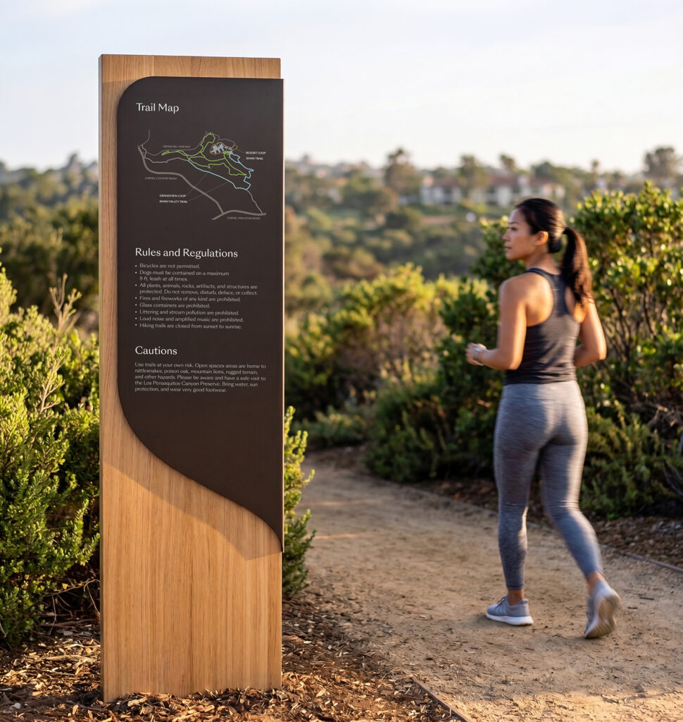
At Altitude Design Office, we approach map design as part of a larger communication system. A map works in concert with signage, architecture, landmarks, lighting, and environmental cues to help people move through a place with clarity and ease.
Whether integrated into a hospital campus, mixed-use development, workplace, museum, or public environment, maps help transform complex places into understandable experiences.


Good maps are rooted in information design. That means organizing complex information in an intuitive way people can quickly understand and use. The challenge is rarely about showing everything. It is about showing the right things, in the right order, with the right hierarchy.
People interact with maps differently depending on their familiarity with a place, stress level, mobility, language, age, or reason for being there. A first-time visitor arriving at a medical campus processes information very differently than an employee navigating a workplace they use every day. Because of this, effective maps rely on structure, hierarchy, contrast, scale, iconography, labeling, and intuitive organization. Every decision influences how easily someone can orient themselves and make decisions.
At Altitude, we think carefully about:
With these factors incorporated, well-designed maps bring structure and clarity to complex environments.
No two environments function the same way, and no two audiences navigate in the same way. A healthcare campus may require multilingual communication, accessible routes, emergency information, and simplified decision points for stressed visitors. A mixed-use district may prioritize landmarks, destinations, parking, retail visibility, and walkability. Hotels and resorts often require maps that highlight amenities, recreation, dining, trails, biking routes, and guest activities while helping visitors quickly understand the broader property experience. Maps must adapt accordingly, then, to provide the most relevant and important information about the specific place.
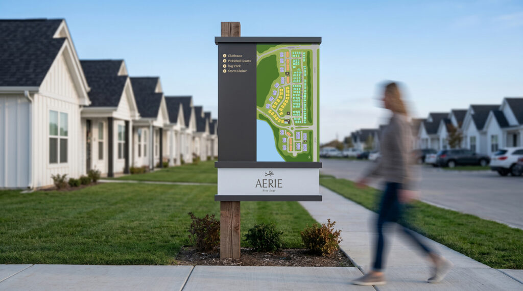
Accessibility is also a critical part of the process. Clear typography, legible contrast, intuitive color usage, and simplified layouts all improve usability for broader audiences. Increasingly, Altitude designers are also considering neurodiversity, cognitive load, and the emotional experience of navigation itself.
Many contemporary wayfinding systems are moving away from overly dense maps filled with visual noise. Instead, the trend is toward simplified, human-centered map experiences that prioritize orientation and understanding over exhaustive detail. Illustrated landmarks, color-zoned districts, recognizable architectural features, 3-dimensional maps, and “you are here” orientation strategies are all increasingly used to help users build mental maps of a place more quickly. In multilingual environments, iconography and universal visual language become especially important. Symbols, spatial relationships, and recognizable destination types can often communicate faster than text alone.
Not every map serves the same purpose. Large physical maps installed within an environment often function as orientation tools. They help people understand the broader context of a place and make decisions at key arrival points such as entries, lobbies, parking areas, elevators, or campus crossroads. These maps must work quickly and sometimes at a distance. Simplicity, visibility, and immediate comprehension become critical.


Printed maps serve a different role. They are typically more personal, portable, and detailed. Visitors may carry them through an environment, reference them repeatedly, or use them to plan a route in advance. Printed maps are especially common in hospitality environments, where guests may reference property amenities, trails, activities, or nearby destinations throughout their stay. Because printed pieces are handled at close range, they can support finer detail, expanded directories, schedules, or layered information. They also need to account for folding, durability, lighting conditions, and ease of use while moving.
While the goals overlap, the design process differs significantly between environmental and handheld formats. A map viewed from eight feet away behaves very differently than one viewed in someone’s hands.
Today, maps often extend beyond static graphics into digital experiences. Interactive kiosks, mobile wayfinding, QR-connected maps, and live directories are increasingly discussed across healthcare, workplace, hospitality, and mixed-use environments. In practice, however, digital wayfinding adoption has been more selective than many initially expected. While clients are often interested in the idea of technology-driven navigation, these systems can require significant long-term investment, coordination with internal IT teams, ongoing updates, and dedicated operational support to remain effective over time.
User behavior also plays an important role. In many environments, people still prefer the simplest and most immediate path to information. A well-placed sign, a printed map, or a conversation with a receptionist is often faster and more intuitive than navigating a kiosk or downloading a dedicated app for a single visit.

As a result, digital tools are most effective when they support the broader wayfinding experience rather than attempting to replace it. The strongest systems remain rooted in clear environmental communication that works intuitively within the physical space itself. At Altitude, we see digital mapping as one layer within a larger communication system. Technology can add value in the right context, but clarity, ease of use, and long-term maintainability remain the foundation of successful wayfinding.
The most effective maps help people quickly understand where they are, where they need to go, and how a place is organized. They reduce uncertainty in stressful moments. They reveal relationships between destinations. They support exploration. They reinforce identity. They create confidence. Most importantly, they help people move through places with greater clarity and ease.


